1
/
of
1
Landmark Booksellers
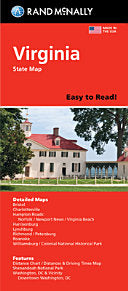
Rand McNally Easy to Read Folded Map: Virginia State Map
Rand McNally Easy to Read Folded Map: Virginia State Map
Regular price
$7.99 USD
Regular price
Sale price
$7.99 USD
Quantity
Couldn't load pickup availability
Rand McNally's folded map for Virginia is a must-have for anyone traveling in or through the state, offering unbeatable accuracy and reliability at a great price. Our trusted cartography shows all Interstate, U.S., state, and county highways and much more. -Points of interest. -State park chart. -State mileage chart. -Driving times map. -On-the-road toolbox. -Visitor center information. -Climate data. -State facts & symbols. -Easy-to-use legend. -Detailed indexed. Coverage Area: Detailed maps include, Alexandria/Arlington, Bristol, Charlottesville, Hampton Roads: Norfolk/Newport News/Virginia Beach, Lynchburg, Richmond/Petersburg, Roanoke, Shenandoah National Park, Washington, D.C. & Vicinity, Williamsburg/Colonial National Historic Park. Product Details: Measures 9.0 x 4.125 and folds out to 25.5 x 36.75.
Share